MYTH IN THE CITY
DARIIA HRYSHCHENKO
This article examines how myth operated as a generative force for the urban formation of Kyiv at two transformative and ideologically divergent moments: the 1830s, when the city was reimagined as a 'Holy City' within the Orthodox cosmology of the Russian Empire and the period between 1923 and 1930, when Soviet planners sought to implement the Marxist idea of proletarian ascendancy. Myth, as Roland Barthes conceives it, functions as a 'second-order semiological system' through which ideology is naturalised and rendered self-evident (2014, 223). In urbanism, this process manifests materially, as metaphysical narratives and ideological doctrines are translated into the organisation of streets, the placement of monumental structures, and the hierarchy of spatial ensembles.
Mircea Eliade's notion of the axis mundi further illuminates this translation: through separation and socially produced space sacred and cosmologically significant points of orientation in the city give physical form to the link between earthly and transcendent order (Eliade 1959, Lefebvre 1991). In Kyiv, both periods reveal how ideological myth, whether sacred or secular, functioned as a spatialising force, producing urban syntax that legibly inscribed authority and order onto the cityscape.
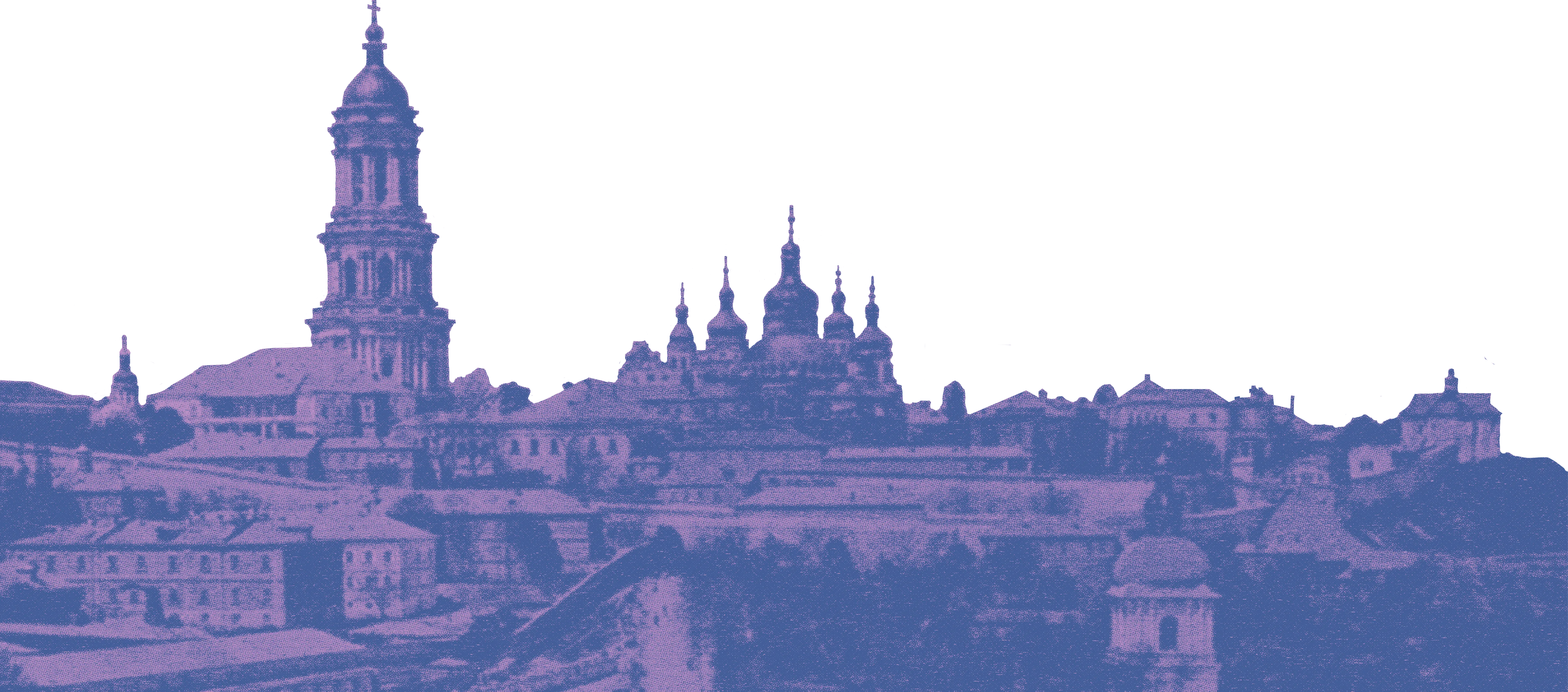
In the 1830s, the Russian imperial administration pursued an agenda of urban mythmaking in Kyiv, mobilising Orthodox-Christian cosmology to legitimise political power. The Polish November Uprising of 1830–31 had exposed the fragility of Russian control over the western provinces, where Polish elites retained disproportionate influence (Bilenky 2018, 17). Kyiv, with its diverse population of Poles, Ukrainians, Jews, and Russians, became a stage upon which imperial authority could be spatially reaffirmed (Liber 1992, 12). By order of Tsar Nicholas I, planners and architects sought to materialise the myth of Kyiv as inherently 'Russian Orthodox' and 'holy', appropriating its historical connection to the Baptism of Kyivan Rus in 988 and framing the city as a 'New Zion' (Tolochko 2004, 250–253; Bilenky 2018, 4). This myth was implemented through spatial hierarchy: the divine, the Tsar, the clergy, and subjects were inscribed into urban form through elevation, centrality, and visibility. The city's natural topography (hills on the Right Bank of the Dnipro River and flat plains on the Left) was used to reinforce this hierarchy. The Kyiv Pechersk Lavra, a prominent cave monastery, situated atop a hill on the Right Bank, functioned as an axis mundi, establishing a visual and symbolic centre that dominated both skyline and consciousness. Pilgrimage routes to the Lavra ascending from Podil, the merchants' district within the city, and the towns of Vasylkiv and Bilohorodka from the outside translated this cosmology into bodily experience.
The picturesque ensemble of churches scattered across the hills along the Dnieper further reinforced the Orthodox vision of sacred geography and was widely recognised as iconographic (Bilenky 2018, 20). While it could be argued that Kyiv lacked a spatial diagram reflecting the transition from the square, signifying earth, to the circle, signifying the divine, this critique primarily applies to the period between 1700 and 1800, when Kyiv was defined by the three separate settlements of Pechersk, the Old Town, and Podil (Kostof 1991). By the 1830s, the imperial urban programme sought to consolidate these areas through expansion inland on the Right Bank. The introduction of a Roman-inspired grid, which was used to assert the idea of the 'holy military city' adapted to the hilly topography, balancing the irregular terrain with a rationalised spatial order in divine discourse (Bilenky 2018, 90). The grid functioned not only as a mechanism of practical urban organisation but also as an instrument of imperial control and surveillance, transforming sacred topography into a legible civic hierarchy (Beebeejaun 2021).
Within this framework, the placement of key structures articulated the mythological and political narrative. Churches dominated the skyline, asserting religious supremacy; the Palace occupied another hill but remained subordinate in scale and prominence, maintaining the theological hierarchy of God over Tsar. Podil, the mercantile district located along the lower riverbank, was deliberately marginalised in elevation, reinforcing social and cosmological ordering. The centripetal organisation around the palace consolidated the urban pull toward a mythologically sanctioned epicentre, producing a city in which belief became geometry, and imperial authority assumed the guise of cosmic inevitability. The 1830s plan thus enacts what might be described as ritual spatiality, in which movement, perspective, and built form collectively reinforce the narrative of Orthodox cosmology and imperial legitimacy.
A century later, between 1923 and 1930, Kyiv became the site of an analogous, yet ideologically inverted, exercise in urban mythmaking under Soviet authority. The Soviet state sought to materialise the Marxist myth of proletarian ascendancy, conceiving the city as a medium through which socialist ideology could be naturalised and experienced spatially. The reconfiguration of Kyiv during this period replaced vertical sacred hierarchies with horizontal collectivism: churches were demolished or repurposed (including Lavra, which was turned into an antireligious museum in 1929), and industrial plants were constructed chaotically under 'Temporary Building Regulations', along new axes until 1934 when Kyiv became the capital of the Ukrainian SSR, and the General Plan of Kyiv was developed in 1936 (Ponomaryova and Ryan 2021). These industrial complexes asserted the primacy of production over transcendence, and the symbolic and functional centre of the city shifted from the ecclesiastical ridge of the Right Bank towards the industrial and administrative nodes of newly built districts, stepping away from the square aspiration of the imperial 'Holy City'.
The Soviet approach to spatial order retained a selective continuity with imperial techniques, particularly in the use of centralisation and grid-based planning. Key administrative and ideological buildings from the imperial period were often repurposed to signify the authority of the proletariat over the bourgeoisie. Yet, unlike the verticality of the 1830s, new districts were laid out away from the Right Bank's hills, emphasising horizontality and uniformity and consequently embedding the myth of proletarian equality into the city's morphology (Lissitzky 1984). The grid, inherited from earlier imperial plans, was reinterpreted as a rationalist instrument for revolutionary efficiency rather than imperial control, reflecting the Marxist privileging of functional and collective logic over symbolic hierarchy (Lissitzky 1984). Despite this transformation, the spatial imprint of prior myths persisted, as historical churches and streetscapes continued to punctuate the skyline and inform urban legibility (Bilenky 2018).
Soviet planners articulated ideological myth through both the location of these structures and how people interacted with them. Palaces of Culture, administrative buildings, and factories were constructed in each respective district, with the main administrative centre located to the west of the pre-existing Palace, diminishing its status to reflect collective production and civic participation, creating an almost ritualistic urban experience similar to the pilgrimage routes of the 1830s. In both cases, movement through the city enacted belief, whether in the divine order or in socialist transformation. The shift from sacred verticality to secular horizontality exemplifies the implementation of myth, illustrating the capacity of ideology to shape not only what is built but how it is inhabited, perceived, and navigated.
A comparison of the two periods underscores both divergence and continuity in the urban deployment of myth. In the imperial period, vertical hierarchy and ecclesiastical dominance codified the cosmic order and legitimised Tsarist authority, while in the early Soviet era, horizontal collectivism and industrial centrality naturalised the authority of the proletariat. Both periods, however, conceived the city as a 'cosmos in miniature', in which order, hierarchy, and a symbolic centre were essential for the distribution of ideological narratives.
Both regimes utilised grid-based planning, yet while the imperial grid functioned as an explicit instrument of surveillance and control, the Soviet grid was portrayed as rational urban design for functionality. Both periods utilised monumental architecture to signify authority, whether through gilded domes, palaces, or industrial plants. In both cases, the city became a semiotic system where ideology was encoded through geometry.
The persistence of myth across regimes also reveals the layered nature of urban semiotics. Structures, routes, and visual hierarchies instituted in one ideological system leave enduring traces which subsequent regimes either incorporate or displace. The historic churches in the skyline of the cityscape continued to inform perception and movement even as new ideological layers were added in the Soviet period. This interplay between continuity and rupture demonstrates that urban form is a medium through which power, ideology, and belief are enacted materially.
Ultimately, a comparative analysis of Kyiv's urban form in the 1830s and 1920s illustrates how myth functions as both an instrument and a product of urban planning. In both cases, architecture materialised myth, whether divine or proletarian. The city became a diagram of ideological cognition, a tangible representation of cosmological and political narratives. Kyiv's urban fabric, therefore, exemplifies how belief can assume geometric form, producing a space which legitimises authority, shapes experience, and renders ideology understandable. The distinct approaches of these two periods, while ideologically opposed, converge in their recognition of the city as a canvas for mythic inscription, demonstrating the enduring role of semiology in the study of urban form and the production of ideological space.

BIBLIOGRAPHY
Barthes, Roland. 2014. Mythologies. Paris: Contemporary French Fiction.
Bazhan, Mykola Platonovych, and Akademiia Nauk Ukraïns'koï RSR. 1969. Soviet Ukraine. Edited by Mykola Platonovych Bazhan. Kyiv: Editorial Office of the Ukrainian Soviet Encyclopedia, Academy of Sciences of the Ukrainian S.S.R.
Beebeejaun, Yasminah. 2021. "Provincializing Planning: Reflections on Spatial Ordering and Imperial Power." Planning Theory 21(3).
Bilenky, Serhiy. 2018. Imperial Urbanism in the Borderlands: Kyiv, 1800–1905. Toronto: University of Toronto Press.
Eliade, Mircea. 1959. The Sacred and the Profane: The Nature of Religion. New York: Harcourt.
"Heaven Round, Earth Square." 2025. Orthodox Arts Journal.
Kostof, Spiro. 1991. The City Shaped: Urban Patterns and Meanings through History. London: Thames and Hudson.
Lefebvre, Henri. 1991. The Production of Space. Oxford: Basil Blackwell.
Liber, George O. 1992. "Periphery and Center." In Soviet Nationality Policy, Urban Growth, and Identity Change in the Ukrainian SSR 1923–1934. Cambridge Russian, Soviet and Post-Soviet Studies. Cambridge: Cambridge University Press.
Lissitzky, El. 1984. Russia: An Architecture for World Revolution. Cambridge, MA: MIT Press.
Malakov, Dmytro. 2008. Prybutkovi budynky Kyieva [Revenue Buildings of Kyiv]. Kyiv: Kyiv National University of Construction and Architecture.
Ponomaryova, Anna, and Brian D. Ryan. 2021. "Will Kyiv's Soviet Industrial Districts Survive? A Study of Transformation, Preservation, and Demolition of Industrial Heritage in Ukraine's Capital." Journal of Planning History 20(3).
Tolochko, Oleksii. 2004. "Kyievo-rus'ka spadshchyna v istorychnii dumtsi Ukraïny pochatku XIX st." In Ukraïns'ki proekty v Rosiis'kii imperii, edited by V. F. Verstiuk, V. M. Horobets', and O. P. Tolochko, 250–331. Kyiv: Naukova dumka.
Images used: Руслан Шухров on Wikipedia Commons, CC BY-SA 4.0, https://creativecommons.org/licenses/by-sa/4.0/deed.en, Andriy155 on Wikipedia Commons, CC BY 3.0, https://creativecommons.org/licenses/by/3.0/deed.en, Hodja on Flickr, CC BY-NC 2.0, https://creativecommons.org/licenses/by-nc/2.0/